How Technology Ushers in Spring in Minnesota, Even During a Pandemic
5/15/2020 9:58:55 AM
During a typical spring, the sight of farmers in the field signifies to Minnesotans that the ground has shaken off the hard winter’s frost, and it is time to start the annual planting that will end up feeding the world. During a time of social distancing, we may not be making the same trips that would bring us these sights. State technology allows us to not only understand how farmers are continuing their essential work, but also how agricultural work is shaped and supported by technology throughout these planting months. Learn more about how agriculture and the planting season is driven by technology.
Before any planting can begin, farmers, and anyone planting in the state, know that the soil must be at a certain temperature. The Minnesota Department of Agriculture (MDA) maintains a Six-Inch Soil Temperature Network that provides real-time soil temperatures at locations across the state. The network helps manage best practices for fall nitrogen fertilizer application but can also help planters understand soil temperatures at any time of the year.
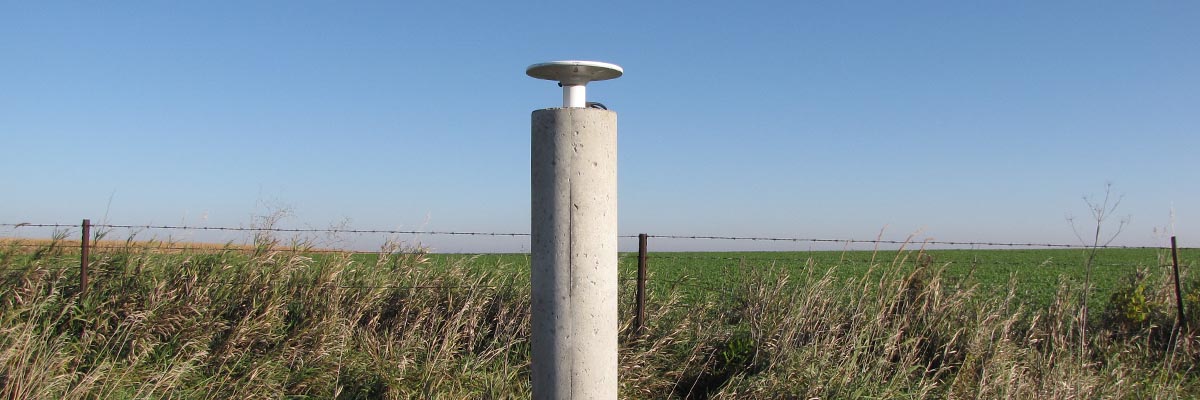
While out in the field, the exact planting location for a corn seed can make the difference for an efficient, productive harvest. Many within the state of Minnesota use an application called MnCORS, which Minnesota IT Services (MNIT) built in partnership with the Minnesota Department of Transportation (MnDOT), other state agencies, counties, cities, and private enterprises. Originally implemented by MnDOT to provide real-time GPS access for MnDOT survey crews, MnCORS now also provides real-time location corrections for the general public, including Minnesota farmers.
In the early days of GPS adoption by the agriculture industry, farmers had the ability to record location information while operating farm equipment in the field. The recorded GPS location, however, was not precise because of the distance that the information traveled between the farmer and the satellite. To create precision, farmers would use the GPS location to correct the information after-the-fact to produce soil, terrain and yield maps for future seasons. Today, modern farm equipment—used in conjunction with the MnCORS real-time GNSS network corrections—allows farmers to guide or fully steer equipment, monitor soil conditions, yields, fertilizer and water rates, and more. All of this occurs in real-time, visualized on a multi-function display screen in the cab.
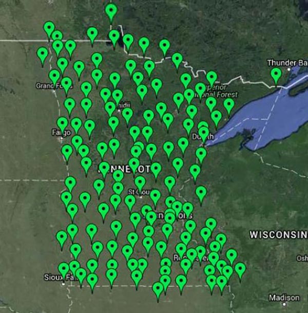
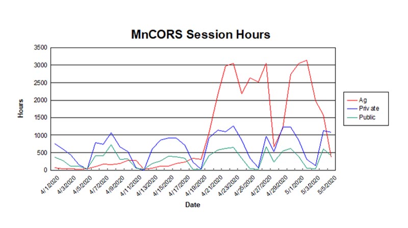
In spring, the corrected location data from MnCORS tells farmers which fields need to be tilled and where certain crops are to be planted, setting them up for a successful harvest. Across Minnesota, more than 1,900 organizations use MnCORS to improve real-time surveying and mapping accuracy for many industries, including agriculture. From the MnCORS data in April, we can see that farmers are hard at work preparing this season’s harvest.
Minnesota’s 511 network is another GIS application that provides a critical state service to farmers and other producers planning trips to weekly farmer’s market stand or other destinations. This MnDOT application helps travelers access information about road conditions, traffic incidents, commercial vehicle restrictions, and weather information any time of the day or night.
Minnesota’s vibrant agricultural industry helps to feed the world. The applications and systems that MNIT and its partners across state government provide for farmers help them to navigate their increasingly technological world, even during a pandemic. Find more information about how state agencies are supporting the community in this time by visiting the websites of Minnesota’s Department of Agriculture and Department of Transportation.
GIS Technology
Technology

