County/Regional Geology Data for Minnesota
This webpage covers geologic data and maps for Minnesota that are generally 1:100,000 to 1:200,000 in scale and that are smaller than the state in extent.- County Geologic Atlas & Regional Hydrogeologic Assessment
- Aggregate Resources (sand, gravel and crushed stone)
- Karst
- Peat
- Other
County Geologic Atlas & Regional Hydrogeologic Assessment
The County Geologic Atlases and Regional Hydrogeologic Assessments are available for a number of counties. They are interrelated so are described together.
County Geologic Atlas: A systematic study of a county's geologic and ground water resources. Geologic studies include both near-surface deposits and bedrock. Ground water studies include flow systems, aquifer capacity, ground water chemistry, and sensitivity of the ground water to pollution. In some areas sand and gravel deposits, sinkholes, or other features are studied. The atlases are generally 1:100,000-scale.
Regional Hydrogeologic Assessment: This is similar to a County Geologic Atlas in that both geology and ground water are studied. However, an assessment covers a larger area, typically four to nine counties, in less detail. It emphasizes near-surface geologic, ground water, and pollution sensitivity mapping. The assessments are generally 1:200,000-scale.
Most atlas and assessment projects are done in two parts which are published and distributed as two separate products:
- Part A, compiled by the Minnesota Geological Survey, covers basic bedrock and surficial geology and creates databases of information such as wells and soil borings. Part A is completed about two years before Part B.
- Program overview and status map
Provides links to GIS data and finished maps covering surficial geology, stratigraphy, bedrock topography, depth-to-bedrock, subsurface geology and mineral resources.
- Program overview and status map
- Part B, compiled by the Minnesota Department of Natural Resources, covers hydrogeology and ground water sensitivity. Information compiled in Part A is used to create Part B.
- Program overview
Provides links to GIS data and finished maps - Status map includes both Parts A and B
- Program overview
Aggregate Resources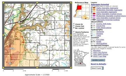
Information on the location and the quality of aggregate resources (sand, gravel and crushed stone).
- Aggregate Mapping Program
Ongoing program of the Minnesota Department of Natural Resources Lands and Minerals Division that maps the location and the quality of aggregate resources for selected counties.
- Overview with status map and links to GIS data, finished and interactive maps.
- Online Aggregate Mapper: Interactive map that displays aggregate, county well, hydrography and reference data.
- Aggregate Source Information System
Interactive and finished maps showing gravel pits, rock quarries and commercial aggregate sources that are either pits owned by the Minnesota Department of Transportation or that are owned by others that may, or may not, be leased by Mn/DOT. - Aggregate Resources 1997, 2020, 2040 for the Twin Cities
Current and projected aggregate resources for Anoka, Carver, Dakota, Hennepin, Ramsey, Scott and Washington counties.
Karst
Karst is an efficiently drained landscape that forms on soluble rock, typified by caves, sinkholes and other landforms. It is mainly, but not exclusively, formed on limestone. In Minnesota, karst is generally found in the southeastern area and in Pine County.
Karst data is often included in County Geologic Atlases and Regional Hydrogeologic Assessments (covered above); however, the following websites focus on karst.
- Karst Features of Minnesota
Database and interactive map of sinkholes and other karst features.- Karst feature inventory points: GIS data
- Minnesota regions prone to surface karst feature development: GIS data and report
- Minnesota Karst poster
Map, photos, block diagram, and background information.
Peat
- Peat Inventory Maps, Reports and GIS Data
Maps and reports of the quantity, quality, type, and depth of the peat deposits within Aitkin, Beltrami, Koochiching, Lake of the Woods and southwest St. Louis counties. GIS data containing information on peat inventory site location, site characteristics, peat profile, botanical origin, and lab analyses for inventory sites (20 counties).
Other
Twin Cities Metro
- Surficial Geology of the Twin Cities Metropolitan Area
- Bedrock Geology of the Twin Cities Metropolitan Area
- Metropolitan Area Groundwater Model
Though developed for groundwater purposes, this model also contains general geology data and information on bedrock, stratigraphy, and glacial drift sand.
Minnesota Geological Survey
- Minnesota Geological Survey Publications
List of all MGS publications (with maps and links)