Elevation Data for Minnesota
This first-stop information website provides an overview of major elevation GIS datasets, maps, and general information available for Minnesota.Contour and Point Data
Sources for contour and point data
Topo Maps
Learn about and view topographic maps
Inventories: Find Existing or Planned Data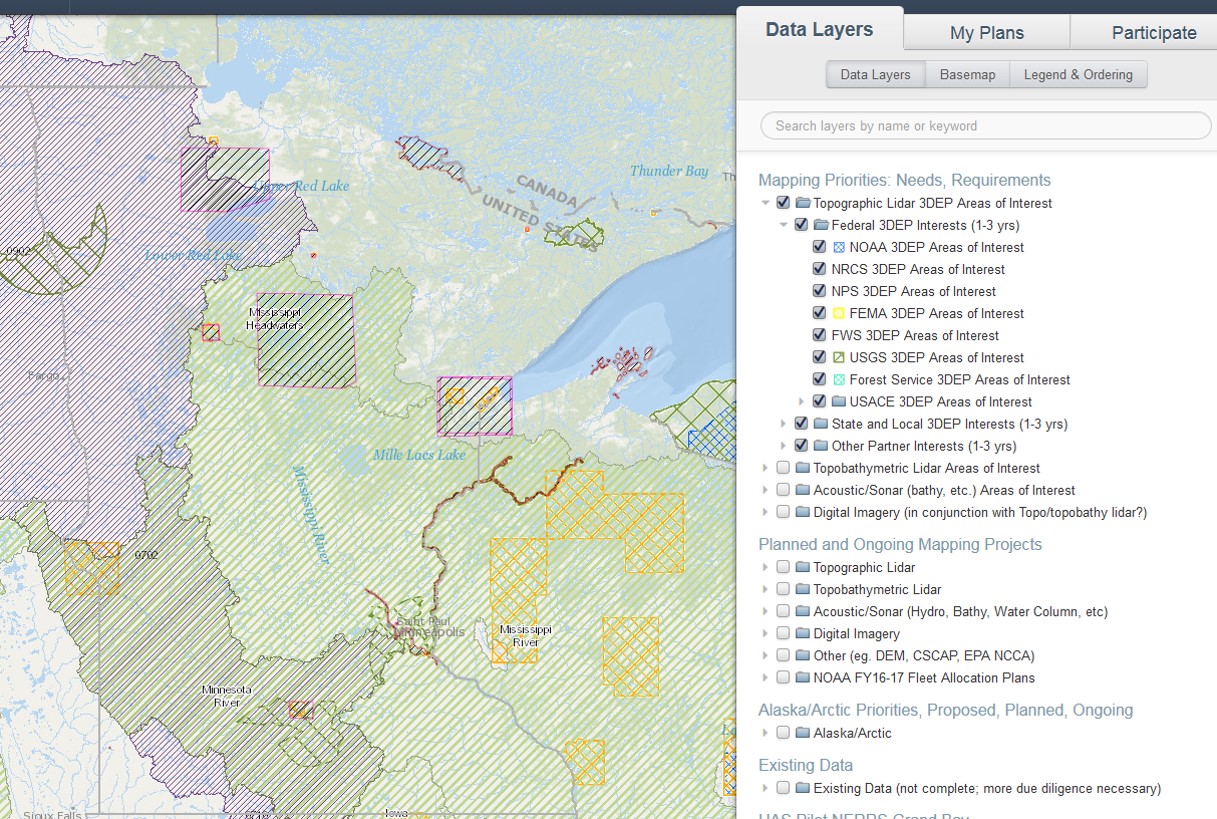
- US Interagency Elevation Inventory (USGS)
This tool is a comprehensive, nationwide listing of known high-accuracy topographic and bathymetric data for the United States and its territories. Use it to explore available elevation data in your area of interest and view basic information about the datasets. - US Mapping Coordination (NOAA)
This project's goal is to help enable coordinated planning between federal agencies and partners in order to meet more than one mapping need with the same data. It hopes to convey where mapping is planned to happen to help eliminate redundant efforts and acquire more data that everyone can use. The site enables sharing requirements and plans, comments and feedback.
Committees and Programs
- 3D Geomatics Committee (Minnesota Geospatial Advisory Council)
This committee promotes planning, funding, acquisition, and management of three-dimensional geomatic data and derived products. - 3D Elevation Program Initiative (3DEP) (USGS)
The primary goal of 3DEP is to systematically collect enhanced elevation data over the United States and the U.S. territories.
Standards
- National Geospatial Program standards, including lidar, 1-meter DEM, and topographic map