

Minnesota County Land Use Maps - 1990s
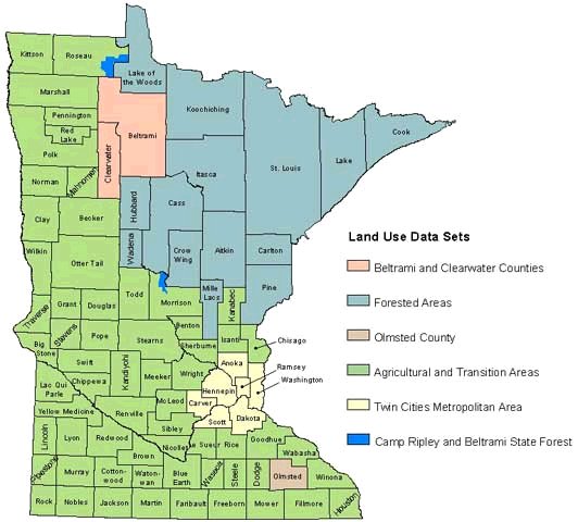
County land use data was collected in the 1990s by multiple different agencies. The data was collected at various times using various methods and aggregated to create the 1990s Census of the Land Map. Each dataset below contains all basic land use types and is available on the Minnesota Geospatial Commons:
- Agricultural and transition areas
- Forested areas
- Twin Cities metropolitan area, 1990
- Clearwater and Beltrami counties
- Camp Ripley and Beltrami Island State Forest
- Documentation for Olmsted County is not available
Additionally, 1990s land use maps for each county are available upon request:
- View a sample PDF (Archived) of Ramsey County 1990s Land Use
- Email MnGeo to request other counties.